This is my third post on early Chinese sources concerning the eastern archipelago. In my first post, I discussed the importance of using old Chinese sources for reconstructing the historical geography of Southeast Asia. My second post reviewed possible references to the eastern archipelago in the third-century CE text Account of Foreign Countries in the Wu Period (Wúshí Wàiguó Zhuàn 吳時外國傳), written by Kāng Tài (康泰), as well as the possible identity of the “chicken-tongue aromatic” (jīshéxiāng 雞舌香). If you have not read those posts, I recommend starting there.
In this post, I want to highlight a terrific online source on Chinese knowledge of the world beyond their shores in the thirteenth century CE:
A Chinese Gazetteer of Foreign Lands translated and edited by Shao-yun Yang
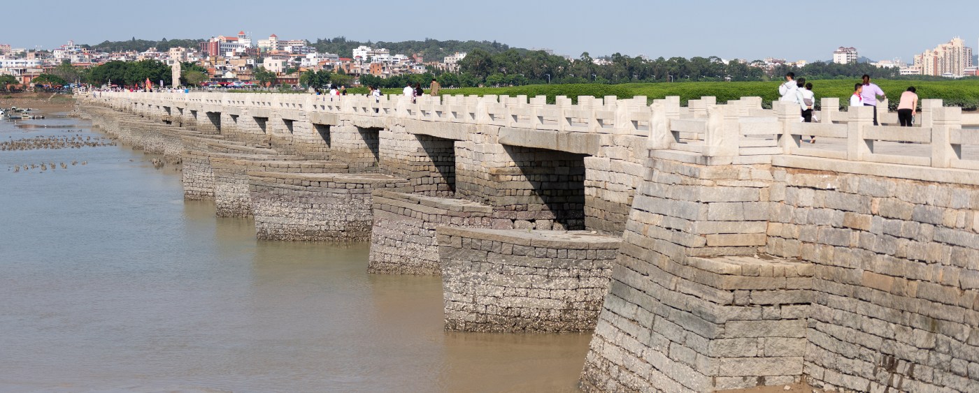
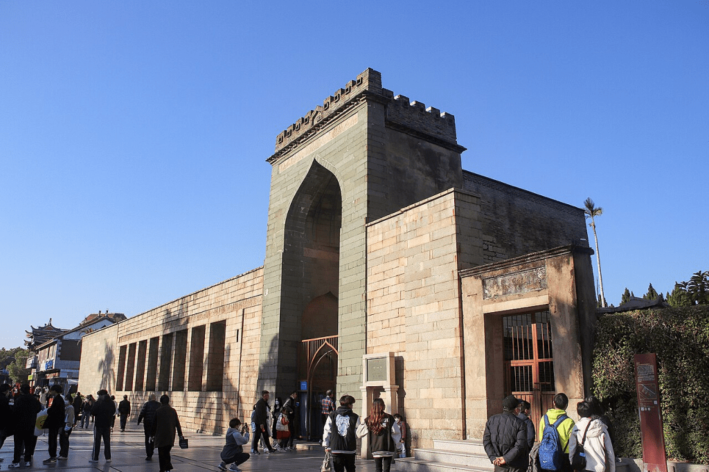
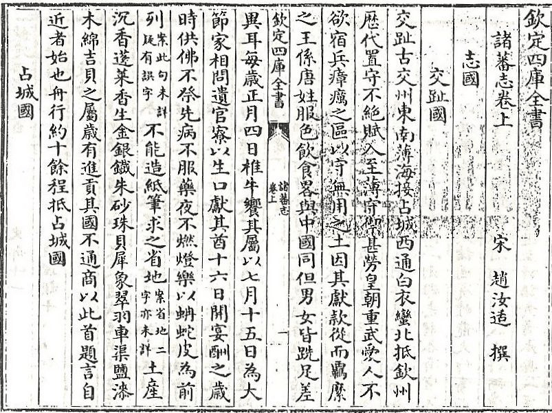
In the website linked above, historian Shao-yun Yang maps and annotates a translation of the first part of the early thirteenth-century Gazetteer of Foreign Lands (Zhū Fān Zhì 諸蕃志) by Zhào Rǔkuò (趙汝适). Zhao Rukuo was an official of the Southern Song Dynasty (1127–1279 CE) who served as a supervisor of maritime trade in the port city of Quanzhou, in present-day Fujian Province on China’s southeastern coast. Although he never personally left China, Zhao collected information from sailors who had traveled beyond China’s shores and also consulted earlier Chinese sources. The text is generally dated to around 1224–1225.
(source: Wikimedia Commons)
Shao-yun Yang’s site covers only the first half of the text. The only complete English translation was produced by Friedrich Hirth and William Woodville Rockhill and published in 1911. The title of this text (Zhū Fān Zhì 諸蕃志) itself has been translated in several ways. Hirth and Rockhill note in their preface that it could be rendered as either “A Description of Barbarous Peoples” or “Records of Foreign Nations.” While the latter of those two translations by Hirth and Rockhill also accurately reflects the Chinese meaning, I prefer Shao-yun Yang’s Gazetteer of Foreign Lands.
A version of Friedrich Hirth and William Woodville Rockhill’s version can be found here.
On his site, Shao-yun Yang acknowledges many of the problems with the Hirth and Rockhill translation and consults later annotated editions of the text, notably Yang Bowen’s annotated and punctuated critical edition published in 1996. Importantly, Shao-yun Yang also incorporates more recent scholarship on the historical geography of Southeast Asia, South Asia, and Africa in his analysis of the Gazetteer of Foreign Lands.
As previously noted, Zhao Rukuo’s Gazetteer of Foreign Lands dates to around 1224–1225. By the time Zhao recorded the information provided to him by Chinese and foreign sailors, however, the Chinese had already been trading with Southeast Asian communities for centuries. The Tang Dynasty period (618–907 CE) saw a significant expansion of Chinese commerce with the region. Evidence of this trade can be found in several shipwrecks discovered in Southeast Asian waters, including the ninth-century Belitung shipwreck and the tenth-century Cirebon shipwreck. Neither vessel appears to have been Chinese: the Belitung ship, found off the coast of Sumatra, was likely of Middle Eastern origin, while the Cirebon ship, found off the coast of Java, appears to have been Southeast Asian. Yet both carried large quantities of Chinese ceramics, providing striking evidence of the extent of Chinese commerce across the maritime networks of Southeast Asia and the wider Indian Ocean world.
(image: Wikimedia Commons)
Several works from this period mention polities in Mainland Southeast Asia and the western archipelago, including Sumatra, Java, and the Malay Peninsula. Again, however, I am mostly interested in what Chinese merchants and sailors knew about the islands of the eastern archipelago. It is not until Zhao Rukuo’s thirteenth-century Gazetteer of Foreign Lands that it appears that they were at least aware of some of these islands.
(source: Wikimedia Commons)
Determining whether Zhao Rukuo was in fact describing the eastern archipelago, albeit briefly, hinges on the identification of a place known as 闍婆 (Shépó). In Middle Chinese, the first character may have been pronounced something like dyia or zhia and the second ba or bwa, producing a name resembling Jaba or Jawa. Accordingly, historical geographers have often identified 闍婆 (Shépó) with Java. Indeed, as Shao-yun Yang notes, later Yuan Dynasty (1271–1368 CE) and Ming Dynasty (1368–1644 CE) texts state that 闍婆 (Shépó) was an older name for Java, which they called 爪哇 (Zhǎowā).
[Note: As with virtually all discussions of Chinese sources for the historical geography of Southeast Asia, there is no universal agreement about the identification of these names with particular places. Notably, historian Liam Kelley has strongly objected to identifying 闍婆 (Shépó) with Java. He argues that the identification of 闍婆 (Shépó) as an earlier name for 爪哇 (Zhǎowā) by later Chinese writers was itself a mistake, not unlike the mistakes modern scholars can make when interpreting historical texts. Instead, Kelley suggests that 闍婆 (Shépó) may have been located near Songkhla in present-day Thailand. He lays out these arguments in his two-part “Rescuing History from Srivijaya: The Fall of Angkor in the Ming Shilu,” as well as in several posts on his blog.]
If 闍婆 (Shépó) does refer to Java, or more specifically to Central Java, then the sections that follow in Zhao Rukuo’s Gazetteer of Foreign Lands may contain important information about the eastern archipelago. East of 闍婆 (Shépó), Zhao mentions a settlement known as 打板 (Dábǎn). In Hokkien, this name could be rendered approximately as táⁿ pán; in Cantonese, daa2 baan2; and in Middle Chinese, perhaps something resembling tang pan. Many historians have therefore speculated that this refers to Tuban in eastern Java.
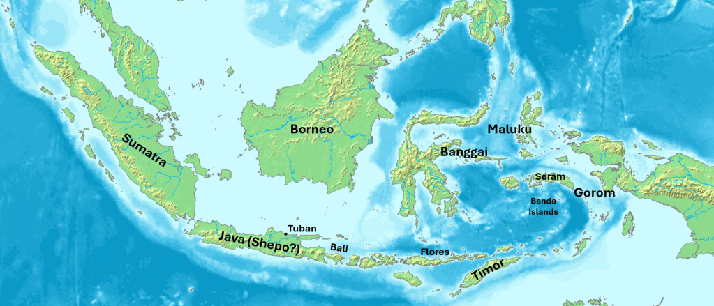
In describing the lands to the east of what may be the settlement of Tuban on the island of Java, Zhao mentions some major “pirate states”. These islands and polities include 牛論 (Niúlùn), 底勿 (Dǐwù), 平牙夷 (Píngyáyí), and 勿奴孤 (Wùnúgū).
I have already provided the modern standard Mandarin pronunciations rendered in Hanyu Pinyin. If we look instead at Hokkien and Cantonese pronunciations, as well as reconstructions of Middle Chinese, we arrive at names that bear a much greater resemblance to actual places in the eastern archipelago. In varieties of modern Hokkien, for example, 牛論 might be pronounced something like “Gu-lun”, 底勿 as “Ti-mai” or “Ti-bo”, 平牙夷 as “Pin-gei-yi”, and 勿奴孤 as “Bo-lu-ko” or “Mai-lu-ko”.
Referring to the archipelago, these could be Gorom, Timor, Banggai, and Maluku. Of course, this is speculative. I have provided my transliteration notes below:
[Note: The Pe̍h-ōe-jī system for Hokkien often includes transliterations for several dialects and pronunciations of individual characters]
牛論 – Gorom
Mandarin (Hanyu Pinyin): Niúlùn
Hokkien (Pe̍h-ōe-jī): gû/giû/ngiû lūn
Cantonese (Jyutping): ngau4 leon6
Middle Chinese (Baxter): ngjuw lwonH/lwon
底勿 – Timor
Mandarin (Hanyu Pinyin): Dǐwù
Hokkien (Pe̍h-ōe-jī): té/tí mài/but
Cantonese (Jyutping): dai2 mat6
Middle Chinese (Baxter): tejX mjut
平牙夷 – Banggai
Mandarin (Hanyu Pinyin): Píngyáyí
Hokkien (Pe̍h-ōe-jī): pîⁿ/pêⁿ/piâⁿ/piêⁿ/pêng gê/gêe/giêe/gâ î
Cantonese (Jyutping): ping4 ngaa4 ji4
Middle Chinese (Baxter): bjaeng ngae yij
勿奴孤 – Maluku
Mandarin (Hanyu Pinyin): Wùnúgū
Hokkien (Pe̍h-ōe-jī): mài/but lô/nô͘ ko
Cantonese (Jyutping): mat6 nou4 gu1
Middle Chinese (Baxter): mjut nu ku
In addition, several other “pirate states” are listed: 打綱 (Dǎgāng), 黃麻駐 (Huángmázhù), 麻籬 (Málí), and 丹戎武囉 (Dānróngwǔluō). 打綱 (Dǎgāng) remains unidentified, while 麻籬 (Málí) is possibly a reference to Bali. Shao-yun Yang suggests that 黃麻駐 (Huángmázhù) may have been Labuan Bajo on Flores, though I am not fully convinced by this identification. 丹戎武囉 (Dānróngwǔluō) may refer to Tanjungpura in Borneo, though Zhao Rukuo may have been using the name more broadly for much of southwestern Borneo. Below are my transliteration notes:
打綱 – [unidentified]
Mandarin (Hanyu Pinyin): Dǎgāng
Hokkien (Pe̍h-ōe-jī): táⁿ kong
Cantonese (Jyutping): daa2 gong1
Middle Chinese (Baxter): taengX kang
黃麻駐 – [unidentified]
Mandarin (Hanyu Pinyin): Huángmázhù
Hokkien (Pe̍h-ōe-jī): n̂g/ûiⁿ/hông môa/bâ/mâ chù/chì/chū
Cantonese (Jyutping): wong4 maa4 zyu3
Middle Chinese (Baxter): hwang mae trjuH
麻籬 – Bali
Mandarin (Hanyu Pinyin): Málí
Hokkien (Pe̍h-ōe-jī): môa/bâ/mâ lî
Cantonese (Jyutping): maa4 lei4
Middle Chinese (Baxter): mae lje
丹戎武囉 – [Tanjungpura or southwestern Borneo?]
Mandarin (Hanyu Pinyin): Dānróngwǔluō
Hokkien (Pe̍h-ōe-jī): tan liông/jiông bú lo/lô/lō
Cantonese (Jyutping): daan1 jung4 mou5 lo1
Middle Chinese (Baxter): tan nyuwng mjuX la
Interestingly, all of these “pirate states” are listed as vassals of 闍婆 (Shépó). Again, if we assume that 闍婆 refers to Java, this would place Zhao’s account around the beginning of the Singhasari period (ca. 1222–1292 CE), when rulers in eastern Java, based near present-day Malang, were beginning to exert influence across parts of the archipelago. Singhasari immediately preceded the much larger and more famous Majapahit polity of eastern Java.
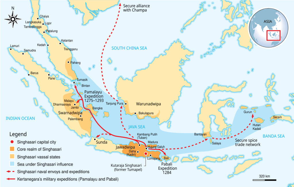
Shao-yun Yang’s site does not provide an annotated translation of the second half of Zhao Rukuo’s Gazetteer of Foreign Lands. That portion of the text, however, contains valuable information about the commodities Chinese merchants sought to procure from the ports of Southeast Asia, including sandalwood, cloves, and nutmeg. Here, I refer back to Hirth and Rockhill’s translation.
Sandalwood (tánxiāng 檀香), Zhao states, could be found at 打綱 (Dǎgāng), an unidentified location, and 底勿 (Dǐwù), the place possibly identifiable as Timor. This identification would certainly make sense, as sandalwood (Santalum album) was historically exported from Timor and Sumba in the Lesser Sunda Islands, also known as Nusa Tenggara.
Curiously, Zhao claims in the next section that cloves (dīngxiāng 丁香; literally “nail aromatic”) came from 闍婆 (Shépó), which many scholars identify with Java, rather than 勿奴孤 (Wùnúgū), which may be Maluku. If these identifications are correct, Zhao was mistaken about the actual origin of cloves. His account may instead reflect confusion between the place where Chinese merchants purchased cloves and the islands where the spice actually grew.
This raises an interesting possibility. Perhaps many Chinese merchants in the thirteenth century were still traveling only as far east as Java. From their perspective, Java may simply have been where cloves came from, even though the cloves themselves had traveled westward through intermediary networks from Maluku.
Much like the claims made about the “chicken-tongue aromatic” (jīshéxiāng 雞舌香) discussed in my previous post, the “nail aromatic” was also said to remove bad smells from the mouth. Zhao claims that high officials at the Chinese imperial court placed cloves in their mouths before meeting with the emperor.
Meanwhile, Zhao states that nutmeg (ròudòukòu 肉荳蔻) could be procured in 牛論 (Niúlùn), which may be Gorom. Nutmeg (Myristica fragrans) is indigenous to the Banda Islands, and nearby Gorom historically served as an important trading node in the broader spice trade. For those interested in the early trade networks connecting Banda and Gorom, I recommend Thomas Goodman’s “The Sosolot: An Eighteenth Century East Indonesian Trade Network” and Roy Ellen’s On the Edge of the Banda Zone.
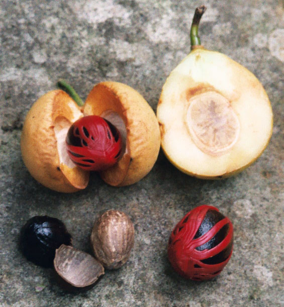
(image: Wikimedia commons)
Zhao also claims that nutmeg could be procured at the site called 黃麻駐 (Huángmázhù), which Shao-yun Yang suggested could be on the island of Flores.
At this point, I want to end by briefly discussing why Chinese writers and officials of this period may have been increasingly interested in learning where commodities such as sandalwood, cloves, and nutmeg actually came from.
In my previous post, I mentioned that several Chinese texts from the second half of the first millennium CE regularly refer to the use of spices. By the Song period, however, the demand for these products had increased considerably.
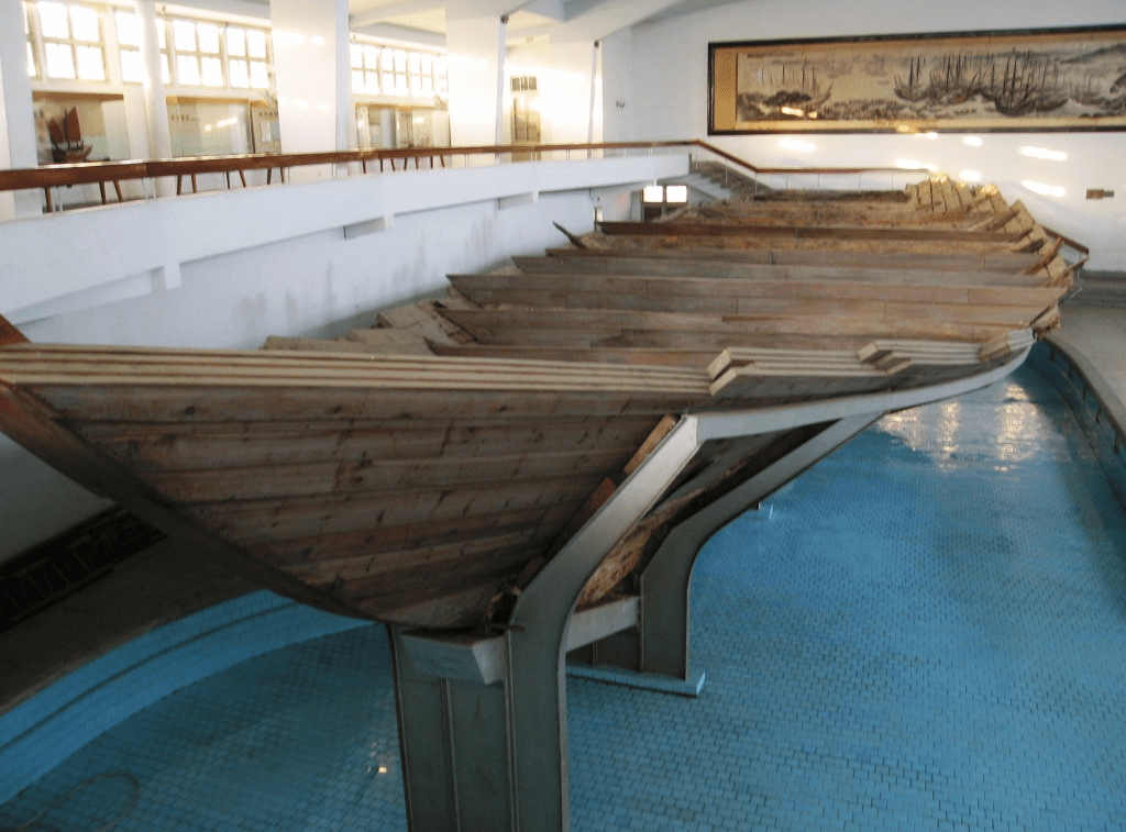
Much of what follows I learned from the first chapter of Guanming Xu’s terrific dissertation, “Pepper to Sea Cucumbers: Chinese Gustatory Revolution in Global History, 900–1840.” By the tenth century CE, spices from the eastern archipelago had become highly sought-after commodities in China in part because of their perceived medicinal qualities. In the eighth century, cloves were known as a perfume ingredient, while nutmeg was known but apparently had no widely recognized medicinal qualities. By the early tenth century, however, cloves and nutmeg had been redefined as warming and digestive medicines thought to have positive effects on the stomach and spleen. They were also considered especially useful for treating a condition that Chinese medical practitioners had long referred to as “cold damage” (shānghán 傷寒).
(source: Wikimedia Commons)
In 1076, the Song Dynasty (960-1279 CE) established the Imperial Pharmacy, which sold ready-made medicines to the public at relatively affordable prices. With imperial support, the pharmacy had ready access to exotic spices and aromatics collected through the Maritime Trade Superintendency. Its products included twenty-six health drinks, twenty-five of which contained at least one spicy or aromatic ingredient, including cloves, nutmeg, or sandalwood.
Zhao Rukuo’s Gazetteer of Foreign Lands was written nearly 150 years after the establishment of the Imperial Pharmacy. By Zhao’s lifetime, these exotic commodities were therefore not merely curiosities arriving from distant lands. They had acquired established places within Chinese medicine and consumption.
That context helps explain why a maritime trade official in thirteenth-century Quanzhou might have been so interested in where sandalwood, cloves, nutmeg, and other commodities actually came from. Zhao himself may never have left China, but the information he collected from the sailors and merchants passing through his port provides us with a remarkable sense of how far Chinese geographical knowledge of the eastern archipelago may have extended by the early thirteenth century. That knowledge was far from complete or perfect, but it nevertheless provides a valuable window into how outsiders may have understood the eastern archipelago.
References
Hirth, Friedrich and William Woodville Rockhill. Chau Ju-Kua: His Work on the Chinese and Arab Trade in the Twelfth and Thirteenth Centuries, Entitled Chu-Fanchï. New York: Paragon Book Reprint Corp., 1966.
Xu, G. “Pepper to Sea Cucumbers: Chinese Gustatory Revolution in Global History, 900-1840,” PhD. Dissertation, Leiden University, 2021.
Yang, Shao-yun. “A Chinese Gazetteer of Foreign Lands: A new translation of Part 1 of the Zhufan zhi 諸蕃志 (1225)”. Last modified January 18, 2025. https://arcg.is/e15vm.
 Benjamin L. Moseley
Leave a comment